Is there a survey of my property on file?
Possibly. In Los Angeles County a survey is public generally only if it was filed with the county — as a record of survey, a tract map, a parcel map or a corner record. They are indexed by book and page, not by owner or address. A survey a past owner commissioned and never filed is not on file.
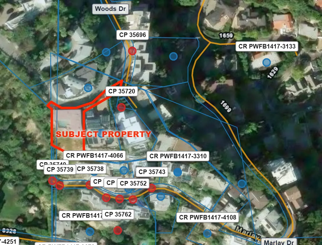
The sample property, 1635 Woods Dr: what one run found
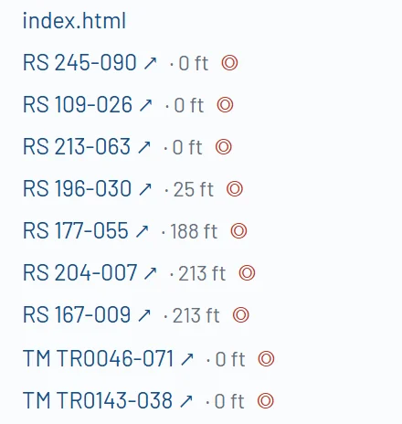
- Records of survey
- 7, 3 of them covering the lot
- Tract maps
- 10, 6 of them covering the lot
- Corner records
- 12, the nearest 40 ft away
- City control points
- 33, with field-book pages
The records, one by one
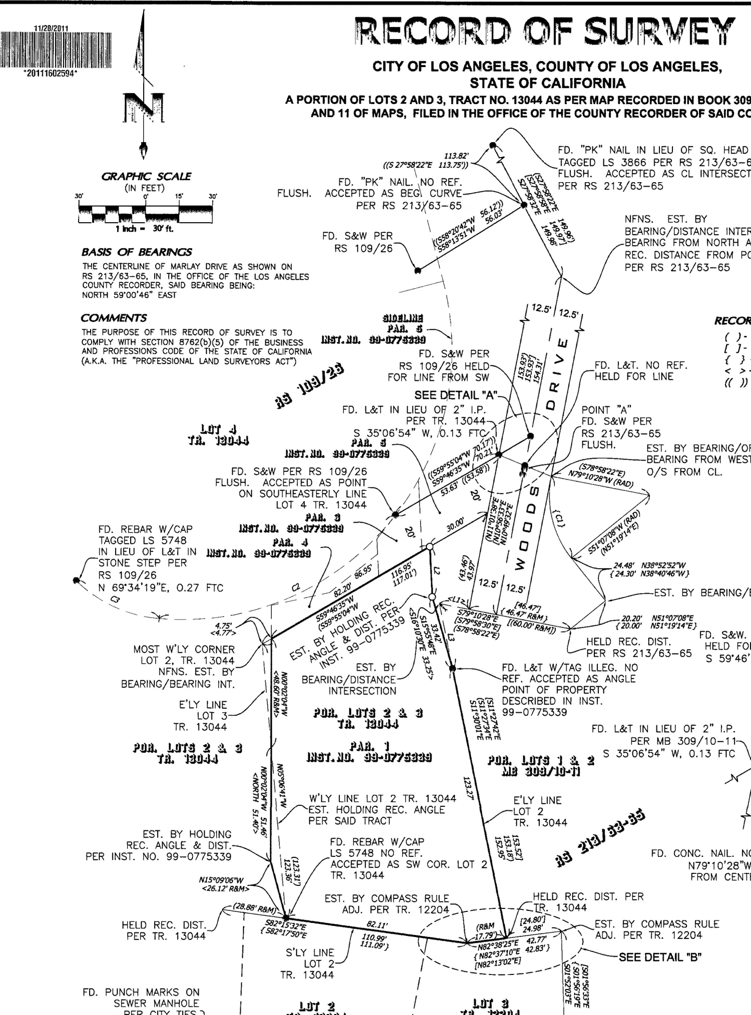
- Basis of bearingsThe line every bearing on the map is measured from.
- A found monumentWhat it is, how it is tagged, and which earlier record it matches.
- The lotsNamed by the tract map that created them.
- Bearings and distancesMeasured along each line, with the record values beside them.
Record of survey
A map of a field survey by a licensed land surveyor, filed with the county. It shows the monuments found or set and the bearings and distances between them. The one shown here covers the sample property: Book 245, Page 90.
Tract map
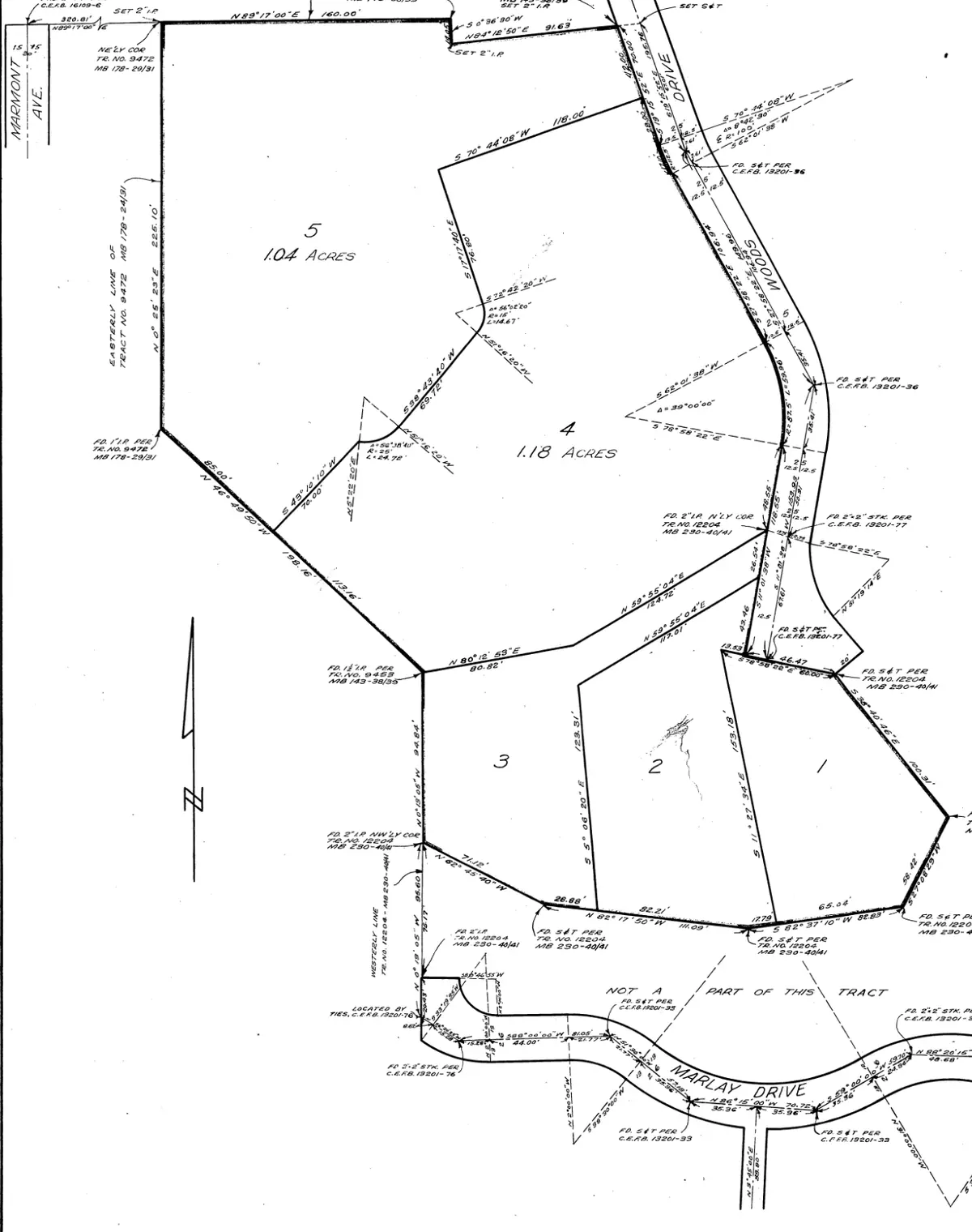
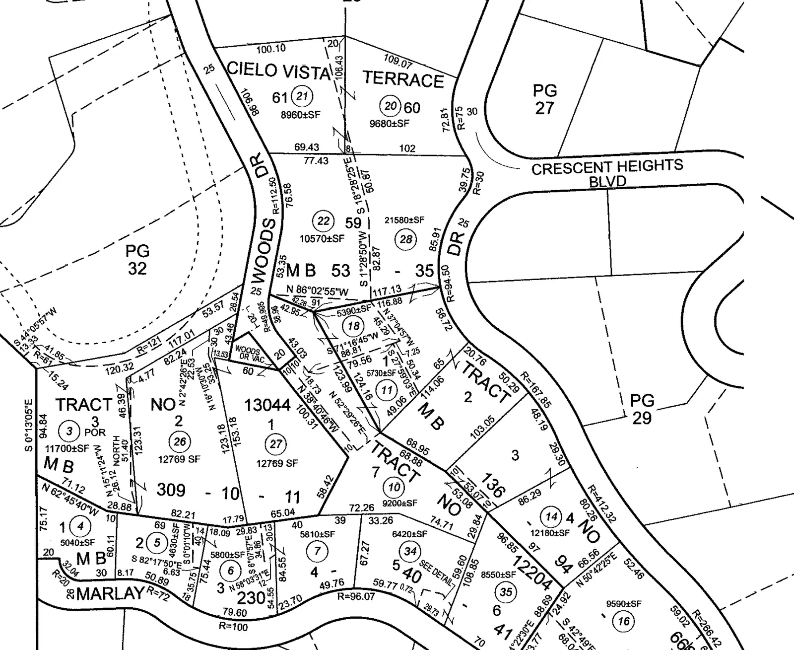
The recorded map of a subdivision — in California, generally five or more lots. Tract maps created most residential lots, and a lot’s legal description usually cites one: the sample property’s begins with Tract No. 13044.
Parcel map
The recorded map of a smaller division, generally four lots or fewer. Tract maps are filed in Map Books and parcel maps in Parcel Map books; both are cited by book and page.
Corner record
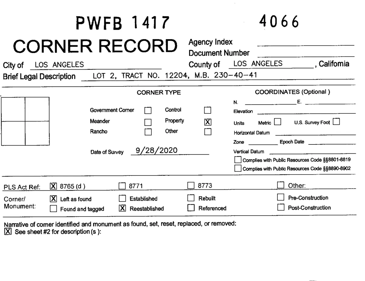
A one- or two-page form a surveyor files when a property corner or another monument is found, reset or re-established. It describes the monument and what it was tied to.
Benchmark
A marked point with a published elevation. A benchmark tells you how high a point is, not where a boundary is.
Survey control and centerline ties
Cities keep their own. The City of Los Angeles publishes survey control points with their field-book pages; several other cities publish the ties that reference their street centerlines.
Where the agencies publish them
The Los Angeles County Surveyor’s Land Records Information site holds the county’s records of survey, tract maps, parcel maps and corner records as scanned documents, along with the County’s centerline notes and benchmarks. The City of Los Angeles publishes its survey control and field books through its NavigateLA map. Other cities in the county publish their own centerline ties or survey records: Azusa, Burbank, Culver City, Glendale, San Gabriel, San Marino, Santa Monica, Signal Hill and Torrance.
All of it is free to look up. Each index is its own, and most are searched by map number or by book and page rather than by street address — which is the work a run does for you.
What the package collects
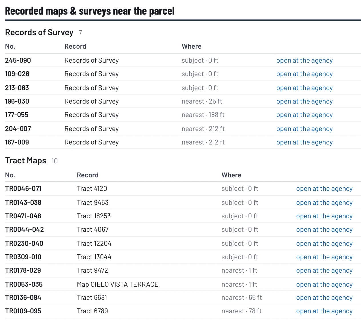
A run searches those indexes around your lot. It always keeps the records that cover the lot itself, then the nearest of each kind around it, out to 660 feet. Each one is placed on the Reference Map with its distance from your property and linked to the agency’s own copy. Tick the ones you want and the documents themselves are added to the package.
For the sample property the run found 7 records of survey, 10 tract maps, 12 corner records and 33 City survey control points. It found no parcel map within range of that lot.
1635 Woods Dr, Los Angeles, view-only. AEC First Phase is not affiliated with this property or its owners.
Looking for a plat map in Los Angeles?
California does not use the word. What other states call a plat is, here, a tract map or a parcel map: the recorded map that created the lots, filed with the county and cited by book and page. Those are the maps a surveyor and a title company work from.
The other thing people mean by “plat map” is the assessor’s parcel map — the page that shows your lot with its parcel number and dimensions. It is drawn to assess property for tax, and it is not a survey. The package holds both: the recorded tract or parcel maps that cover the lot and its neighbors, and the assessor’s map page.
Why a map app’s lot lines are not a survey
The lot lines in Google Maps, on a real-estate site or in a county’s own map viewer are parcel geometry: lines drawn for assessment and mapping and fitted to aerial photographs, not measured from the monuments in the ground. They show roughly where a lot is. They can be off, and nothing about them tells you by how much.
A survey starts from the recorded maps and the monuments, and it is signed by a licensed land surveyor.
AEC First Phase draws the same public parcel lines, says so, and puts the recorded maps and corner records beside them — the documents a surveyor starts from. It does not locate your boundary. If you need a line you can build to, hire a licensed land surveyor and hand them the package.
In the other nine counties
The same search runs in Orange, Ventura, San Bernardino, Riverside, San Diego, Santa Barbara, San Luis Obispo, Kern and Imperial counties, against each county surveyor’s own index where one is published online. What each county publishes differs: some publish every document, one publishes none.
Start with an address.
Free to look with a free account · $5 to take it home · no card needed to run